


Interstate closes amid slick roads, multiple spin-outs as snow hits Colorado
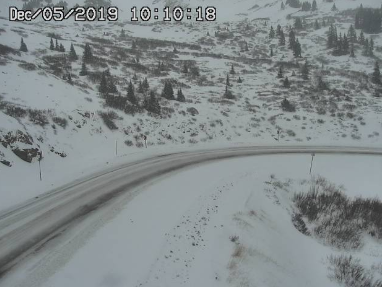
Snow-packed roads on Loveland Pass Thursday morning. Photo Credit: CDOT
Expect winter driving conditions on Thursday morning around Colorado with snow-covered roads and mountain passes across the mountainous region, including I-70 and Highway 6.
Travelers headed to the mountains should be prepared for another round of wintry weather bringing new snow accumulations of 6 to 10 inches to parts of the state through Thursday evening. The San Juan Mountains will likely see the highest accumulations. The I-70 mountain corridor could also see up to 6 new inches of snow, with lighter accumulations likely falling over the I-25 corridor.
Scattered rain/snow showers will continue until this afternoon. Snowfall totals of 4-8″ above 8,500 ft and up to 12″ in the highest elevations. Mountain snow showers will return late Sat and become more widespread on Sun, while the valleys should stay relatively dry. #cowx #utwx pic.twitter.com/BINgyH3Buk — NWS Grand Junction (@NWSGJT) December 5, 2019
The Colorado State Patrol reported deteriorating road conditions across I-70 and Highway 6 between Dotsero and Eagle as snow continues to blanket the high country. I-70 was also shut down early Thursday morning due to multiple crashes and spun out vehicles in the Glenwood Canyon area.
HEADS UP #EagleCounty!!! Multiple crashes on I-70 and Highway 6 between Dotsero and Eagle. Road conditions are very poor with this storm. Please SLOW DOWN and give yourself plenty of time and space! #COwx #cotraffic pic.twitter.com/FSXPQdOBgN — CSP Eagle (@CSP_Eagle) December 5, 2019
#BREAKING Road Closure: I-70 is CLOSED eastbound through the #GlenwoodCanyon due to multiple crashes and spun out vehicles. Expect long delays. No est on reopen. #cotraffic #COwx @GlenwoodPI pic.twitter.com/VdbtfLlnFy — CSP Eagle (@CSP_Eagle) December 5, 2019
Webcams currently show snow-packed roads and low visibilities over Wolf Creek and Monarch Pass. Icy and snowy conditions are also being reported on Loveland Pass, Cameron Pass, Hoosier Pass, Red Mountain Pass, and Poncha Pass. To see a full list of road conditions, click here.
Winter driving conditions can be expected across the higher terrain along the Continental Divide. CDOT cameras are indicating snowpacked roads across Wolf Creek and Monarch Passes this morning. Additional snowfall of 3 to 6 inches will be possible along the ContDvd today. #cowx pic.twitter.com/OajEGBb4RA — NWS Pueblo (@NWSPueblo) December 5, 2019
According to OpenSnow meteorologist Joel Gratz, here’s how much snow has already fallen over parts of the high country starting after midnight on Thursday morning: Purgatory (6″), Crested Butte (4″), Aspen Area (2″), Steamboat (1-2″), Wolf Creek and Silverton (3-4″).
The storm is expected to clear by Thursday afternoon to evening, with the next wave of high country snow rolling in from Sunday evening into Monday.
Timelapse of Byers Canyon this morning…thanks Tara Gourdin! Slick conditions out there. Take it slow and leave plenty of room between yourself and the vehicle in front of you! pic.twitter.com/lbM9QIwhv4 — Grand County Office of Emergency Management (@GrandCountyOEM) December 5, 2019
Please note that all weather statements and snow accumulations are subject to change. We recommend visiting OpenSnow for a full in-depth forecast throughout the winter season.
If heading over high mountain passes, please remember to use extra caution. Take it slow and allow extra time to reach your destination. Keep an emergency kit handy and make sure your vehicle is fully prepared for driving in winter weather. For road conditions and any active chain or traction laws in place around the state, visit Cotrip.org.
Get OutThere
Signup today for free and be the first to get notified on new updates.