


Near record-breaking heat to interrupt rainy trend in some parts of Colorado

Photo Credit: iamyai (iStock).
lamyai
The National Weather Service (NWS) is calling for high temperatures along Colorado’s Western Slope to near record-breaking over the next few days.
“A ridge of high pressure centered just to our west will allow for mostly sunny skies and well above seasonal temperatures today and into the week. Afternoon highs will be 5 to 10 degrees warmer than seasonal for late August, with a few triple digit readings possible,” the service said on Tuesday.
This afternoon, both Montrose and Grand Junction could come within a single degree from their respective daily heat records, according to a tweet from KKCO. Montrose is forecast to reach 91 degrees, and Grand Junction could hit a scorching 96 degrees, with records being 92 and 96 degrees, respectively.
The NWS graph below shows the expected high temps in the area through Wednesday:
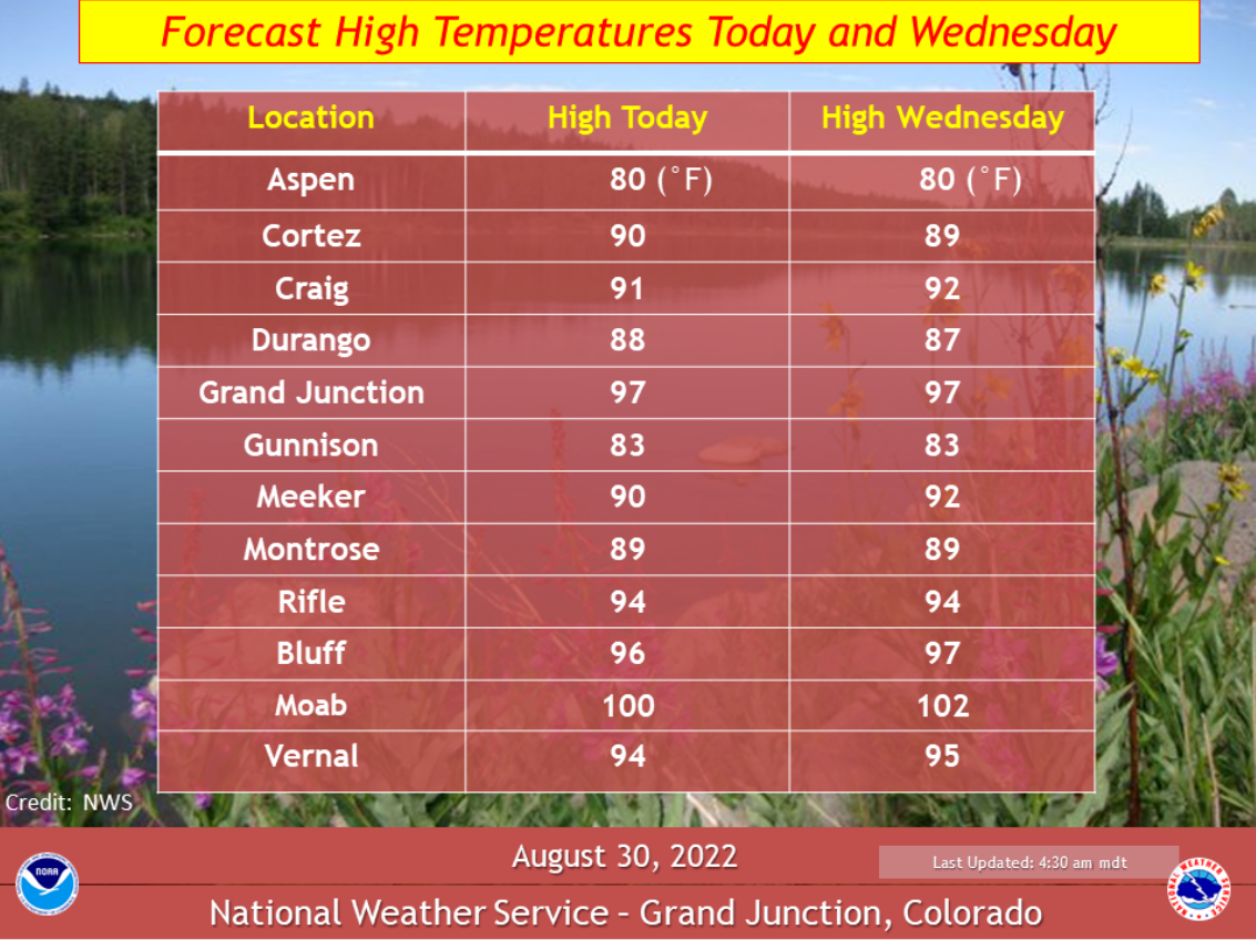
Graph Credit: The National Weather Service

Graph Credit: The National Weather Service
Temperatures this high can be dangerous and are capable of causing heat-related illness. It is important to plan ahead for high temperatures by packing plenty of water if planning any outdoor recreation in these areas.
“The only chance of a shower or thunderstorm will be over the southwest Colorado mountains or near the Continental Divide mountains of west central Colorado. Otherwise, dry, mostly sunny and very warm weather will be the rule for the next several days,” the service said.
STAY INFORMED: Sign-up for the daily OutThere Colorado newsletter here
Get OutThere
Signup today for free and be the first to get notified on new updates.