


Happy Trails: A marvelous tour of trails around Fishers Peak
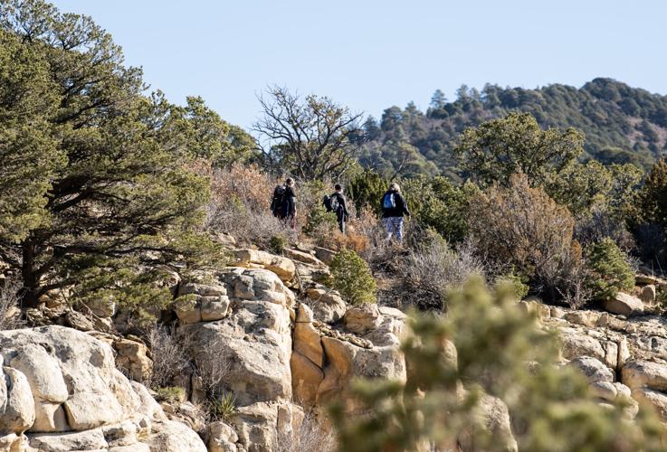
Three hikers make their way up Upper Lone Cub Trail, part of 11 miles of new trail at Fishers Peak State Park.
Parker Seibold/The Gazette
The path to the top of Fishers Peak, one of southern Colorado’s most recognized promontories, could be finished and opened late this summer. It’ll be seasonally closed March through July for falcons nesting in the uppermost cliffs.
But one doesn’t need to wait until then to finally explore the land long held in private hands. That’s thanks to the 3-year-old state park opening 13 miles of trail last October.
Happy Trails: Dodge the mud and enjoy Garden of the Gods on this urban path
Though, you might want to wait until after mud season. Let this whet your appetite — a trip report from our introduction to the trail network back in the fall.
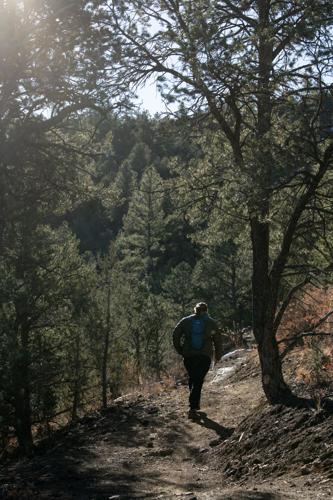
We charted a course to Osita Point, the highest point available now, via the lower and upper Lone Cub trails.
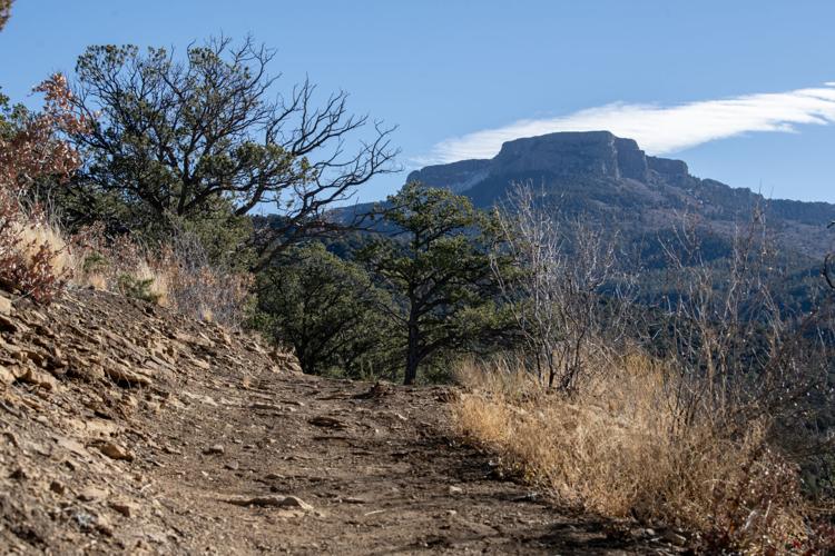
Snowcapped peaks are seen beyond sandstone bluffs at Fishers Peak State Park in Trinidad.
Parker Seibold, The Gazette file

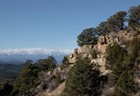
Snowcapped peaks are seen beyond sandstone bluffs at Fishers Peak State Park in Trinidad.
From the parking lot off Interstate 25, we followed the wide path past the gate toward the Challenge Hill. The former ranch road is steep and loose, and we don’t recommend it on the way up or back down. Instead at the junction, go right for the foot bridge and Lower Lone Cub Trail.
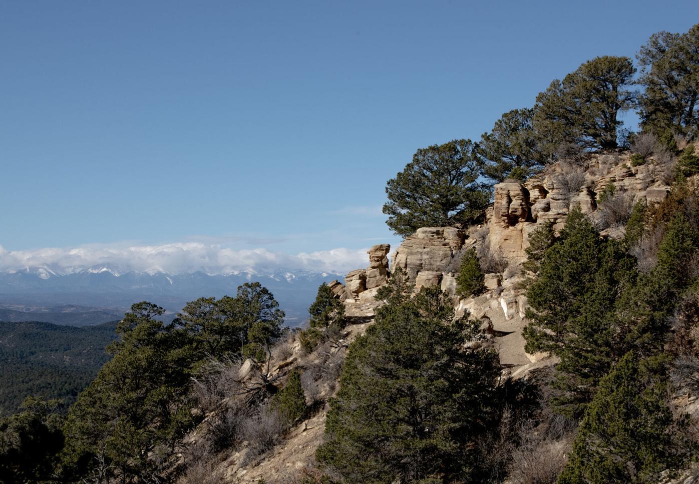
In a little more than 1½ miles, the trail meets Upper Lone Cub Trail. For another 1.2 miles, views of the Sangre de Cristos, Spanish Peaks and Trinidad Lake greet you along with some rocky bluffs and hoodoos.
The trail leads to a circular junction, a resting place to consider going farther on Fishers Peak Trail to Osita Ridge. That’s another 3 miles one way, ending with stone steps to the high point.
Happy Trails: Feeling gratitude on upper loop of north Colorado Springs park
We went back the way we came; at the circular junction, you could opt to proceed down the Challenge Hill/Fishers Peak Trail rather than back on the Lone Cub trails.
Trip log: 10.6 miles round trip (out and back), 2,000-plus feet elevation gain, 8,120 feet max
Getting there: On I-25 in Trinidad, take exit 11, crossing the bridge to the east side of the highway and following the frontage road south to the park entrance.
FYI: Park open sunrise to sunset. No dogs. $9 day pass per vehicle. Hiking and biking; last stretch to Osita Point hiking only. More information and trail map at park website.
SETH BOSTER, THE GAZETTE
Built to last: The Estes Park Aerial Tram, a generationally beloved phenomenon, marks 70 years
Seth Boster
seth-boster@midtc.com
Updated 1 day ago
1 of 15Bob Heron in the cabin of his creation, the Estes Park Aerial Tram.Courtesy of the Heron family2 of 15Robert Heron of Heron Engineering left his mark on the ski industry by designing the early lifts at Aspen, Arapahoe...
Seth Boster
Reporter
When trolleys roamed Colorado Springs streets — and the book that tells their story
Seth Boster
seth-boster@midtc.com
Updated 3 days ago
1 of 4Pikes Peak looms over the Antlers Hotel in 1914 as trolleys roam downtown.courtesy of Pikes Peak Library District2 of 4A 1914 parade on Tejon Street featured one of the original horse-drawn trolley cars from 1887. Courtesy John Haney3...
Seth Boster
Reporter
Highlands Ranch priests seek sainthood for Kendrick Castillo’s ultimate sacrifice
Debbie Kelley
debbie-kelley@midtc.com
Updated 3 days ago
1 of 3John and Maria Castillo, the parents of Kendrick Castillo, speak May 28, 2021, after a hearing outside the Douglas County Justice Center in Castle Rock.The Denver Gazette file2 of 3A photograph of student Kendrick Castillo stands amid a...
Debbie Kelley
Reporter
Trail construction crews needed at Denver foothill trails heading into late summer
Jonathan Ingraham
jonathan-ingraham@midtc.com
Updated 5 days ago
1 of 1A large maintenance crew poses for a photo during a trail construction day at Mt. Falcon Mountain Park west of Denver in summer 2025.Courtesy photo, Front Range Trails Conservancy Facebook Twitter WhatsApp SMS Email Print Copy article link...
Jonathan Ingraham
Reporter
Colorado muralist Kendall Kippley succeeds by being true to herself
HAP FRY Special to The Gazette
hap-fry-special-to-the-gazette@midtc.com
Updated 7 days ago
1 of 2Kendall Kippley, 31, often brings her biggest fan, Kaya, to work with her. The two have a good partnership going.courtesy of Tyler Dittlo2 of 2Kendall Kippley, who grew up in Denver’s Washington Park area and attended Colorado State...
HAP FRY Special to The Gazette
Reporter
From Blodgett Peak to Cheyenne Mountain: Dream trail taking shape in Colorado Springs
Seth Boster
seth-boster@midtc.com
Updated 7 days ago
1 of 3The Chamberlain Trail in North Cheyenne Cañon Park in Colorado Springs.Courtesy city of Colorado Springs2 of 3David Deitemeyer, senior administrator for Colorado Springs’ Trails, Open Space and Parks program, walks a new stretch of the Chamberlain Trail coming...
Seth Boster
Reporter
Jefferson County Open Space forming ‘greenprint’ for next 5 years
Seth Boster
seth-boster@midtc.com
Updated 1 week ago
1 of 1A young hiker perched on shoulders looks back as he and his companion make their way down Fossil Trail in South Table Mountain Park on June 14, 2023.Gazette file photo Facebook Twitter WhatsApp SMS Email Print Copy article...
Seth Boster
Reporter
Guided hikes set for Lost Canyon in Castle Rock
Seth Boster
seth-boster@midtc.com
Updated 1 week ago
1 of 1Justin Spring, state director of The Conservation Fund, stands at the end of a cliff at Castle Rock’s newest and largest-ever open space acquisition, Lost Canyon Ranch. The acquisition was helped by Douglas County’s open space program.the Gazette...
Seth Boster
Reporter
How deep is Colorado’s rural-urban divide? 10 takeaways from the Rural Reckoning series | Vince Bzdek
Vince Bzdek
vince-bzdek@midtc.com
Updated 2 weeks ago
1 of 2Thelma Grimes2 of 2Holly Lawson, clinical coordinator, stands next to a new camera monitor system inside a room at St. Francis Hospital in Colorado Springs on March 25, 2022.Gazette file Facebook Twitter WhatsApp SMS Email Print Copy article...
Vince Bzdek
Reporter
Plans delayed for Sweetwater Lake in western Colorado
Seth Boster
seth-boster@midtc.com
Updated 2 weeks ago
1 of 1The calm waters of Sweetwater Lake reflect the cliffs surrounding the lake Thursday, Nov. 4, 2021, on a sunny fall day.Christian Murdock/The Gazette Facebook Twitter WhatsApp SMS Email Print Copy article link Save Facebook Twitter WhatsApp SMS Email...
Seth Boster
Reporter