


Denver Weather: Mountain snow, foothills winds and icy spots on the plains
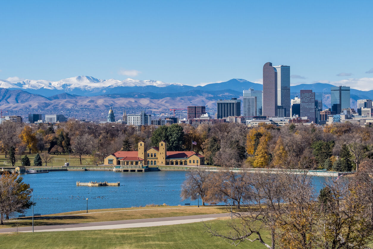
Denver, Colorado. Photo Credit: aoldman (iStock).
aoldman
Today we have a little bit of everything in between storm systems – heavy snow for parts of the mountains and high winds to the Front Range foothills, along with a layer of freezing fog and drizzle on the eastern plains. The I-25 urban corridor will likely remain in between most of those impacts.
Wind gusts in the 40 – 75 mph range will be possible in the foothills into this morning. Gusty winds will diminish to the 20-30 mph range by noon.
The snow showers will likely be widespread and heavy on many of the mountain passes by mid-late morning. There is a winter weather advisory in the central and northern mountains for 4-10 inches of snow with 45 mph winds. So fresh powder will be waiting for you in the Colorado ski country, but the drive will be slick and slow.
The winds and the persistent snow showers will stop short of the Front Range urban corridor but there will be a few isolated snow showers in the late morning hours and even the early afternoon. The snow should be light, and short-lived so very little accumulation is expected during the daylight hours on Saturday. A few spots, like the south Denver metro, could pick up about a half inch of snow but most areas will probably not see snow.
The other threat from the Saturday storm will be a layer of shallow and cold air on the eastern plains that could bring some freezing fog or freezing drizzle. There is a winter weather advisory for mixed precipitation resulting in ice accumulation of up to a half inch. Yuma and Kit Carson counties are included in Colorado, but other areas on the eastern plains could also see some ice accumulation.
Temperatures will stay cold on Sunday as the storm exits through southern Colorado. There will even still be some moisture left over on to spark up a few brief snow showers on the Front Range, but accumulation or impacts are low.
After the chilly and wintery weekend, there will be a nice stretch of sunny and dry weather Monday through Friday. Denver could even get a few temps in the upper 40s or low 50s to end the week before another possible cold blast for next weekend!
The next arctic blast is likely to come rolling into our area by next Saturday, potentially bringing the coldest weather of the winter so far. There is also a bit of a snow signal showing with that polar air so stay tuned to the forecast as the details evolve through the week.
SATURDAY: Partly cloudy with a chance for snow or mixed showers. Breezy winds. High around 45. Partly cloudy overnight, low 16.
SUNDAY: Mostly sunny and cold. High around 36. Quiet overnight, low 12.
MONDAY: Chilly sunshine. High around 37. Mostly clear overnight, low 14.
TUESDAY: Mostly sunny and close to seasonal, high around 42. Mostly clear overnight, low 19.
WEDNESDAY: Sunny with a few clouds, high around 47. Mostly clear overnight, low 22.
THURSDAY: Sunny with a few clouds, high around 53. Mostly clear overnight, low 25.
FRIDAY: Partly cloudy and breezy. High 48. Partly cloudy overnight, low 20.
Colorado State Patrol investigating fatal Grand County wrong-way crash Monday
Michael Braithwaite
michael-braithwaite@midtc.com
Updated 56 minutes ago
1 of 1FILE PHOTOGETTY IMAGES Facebook Twitter WhatsApp SMS Email Print Copy article link Save Colorado State Patrol officers are investigating a fatal, wrong-way crash that took place just south of Kremmling in northern Colorado Monday morning. Crews first responded...
Michael Braithwaite
Reporter
Denver ditches minimum vehicle parking requirements
Deborah Smith
deborah-smith@midtc.com
Updated 44 minutes ago
1 of 2Denver voted on Monday to remove restrictions on the minimum number of parking spaces for all land use across the city. The aim is to spur more space for affordable housing and encourage more "sustainable" transportation. (Photo Credit: grandriver,...
Deborah Smith
Reporter
Denver Mayor Johnston on $1B bond measure: ‘Now the work begins’
Deborah Smith
deborah-smith@midtc.com
Updated 42 minutes ago
1 of 7Denver Mayor Mike Johnston offers words of gratitude to members of the city council and the Vibrant Bond executive committee on Tuesday, Aug. 5. Johnston held a brief press conference on the steps of the Denver City and...
Deborah Smith
Reporter
Legislators urge action as Colorado faces $955 million deficit, unresolved AI regulation
Marianne Goodland
marianne-goodland@midtc.com
Updated 39 minutes ago
1 of 1eyegelb / iStock Facebook Twitter WhatsApp SMS Email Print Copy article link Save Will there be a special session this month? Multiple sources have told Colorado Politics that on Wednesday the governor will call the General Assembly back...
Marianne Goodland
Reporter
Denver International Airport introduces touchless TSA PreCheck ID lanes
None None
none-none@midtc.com
Updated 38 minutes ago
1 of 1FILE PHOTO: TSA Ofc. Martin Anderson stands in the new East Security checkpoint at Denver International Airport during a media walkthrough on Monday, Aug. 4, 2025. The new checkpoint opens Tuesday at 3 a.m. (Stephen Swofford, Denver Gazette)Stephen...
None None
Reporter
Colorado declares disaster emergency, mobilizes resource to fight LeRoux fire
Luige Del Puerto
luige-del-puerto@midtc.com
Updated 21 minutes ago
1 of 1Gov. Jared Polis speaks briefly during Tuesday's post-session State of the State event hosted by the Denver Chamber of Commerce on May 13, 2025.Thelma Grimes Facebook Twitter WhatsApp SMS Email Print Copy article link Save Gov. Jared Polis...
Luige Del Puerto
Reporter
City council sends $1 billion ‘Vibrant Denver’ bond package to voters
Deborah Smith
deborah-smith@midtc.com
Updated 2 days ago
1 of 3Denver Mayor Mike Johnston, flanked by other city officials, announced his plans to launch a "Vibrant Denver" bond program on Feb. 12, 2025 at the Carla Madison Recreation Center at 2401 E. Colfax Ave.2 of 3FILE PHOTO: Outside...
Deborah Smith
Reporter
Downtown Denver aims to double residents by 2045
Bernadette Berdychowski
bernadette-berdychowski@midtc.com
Updated 2 days ago
1 of 1Looking over downtown from the Denver Millennium Bridge on Aug. 1, 2025.Bernadette Berdychowski / The Denver Gazette Facebook Twitter WhatsApp SMS Email Print Copy article link Save What could downtown Denver look like by 2045? The city’s official...
Bernadette Berdychowski
Reporter
Woman dies in Colfax Avenue hit-and-run, Aurora police say
Noah Festenstein
noah-festenstein@midtc.com
Updated 2 days ago
1 of 1File photo. Photo: JasonDoiy (iStock).JasonDoiy Facebook Twitter WhatsApp SMS Email Print Copy article link Save Aurora police are searching for a driver involved in a hit-and-run crash that killed a woman along Colfax Avenue at Interstate 225 on Sunday...
Noah Festenstein
Reporter
Shooting leaves 1 dead, 1 injured in Thornton
Noah Festenstein
noah-festenstein@midtc.com
Updated 2 days ago
1 of 1File photo. Photo: JasonDoiy (iStock).JasonDoiy Facebook Twitter WhatsApp SMS Email Print Copy article link Save Thornton police are investigating a shooting that left one person dead and another in the hospital on Sunday night. The shooting took place in...
Noah Festenstein
Reporter