Flagstaff Mountain: A guide to the scenic road and adventure zone in Boulder
BOULDER • Heavy traffic funnels into Chautauqua Park, the iconic destination home to the Flatirons. But the road does not stop there.
Up it goes past those angling rock formations, onward to Flagstaff Mountain.
“Chautauqua is definitely the most meaningful place in the Boulder area,” says a local hiker, Dorothy Kucar, “but Flagstaff is definitely a close second.”
And perhaps lesser known to the outsider who tends to stop and stick around Chautauqua.
Happy Trails: Appreciating the new and old at Monument Valley Park
But Flagstaff, too, is “central to the identity of Boulder,” says Phillip Yates, a spokesperson for the city’s Open Space and Mountain Parks Department.
Funded by sales tax revenues over generations, the department counts more than 46,600 acres preserved. And it all started around Flagstaff Mountain.

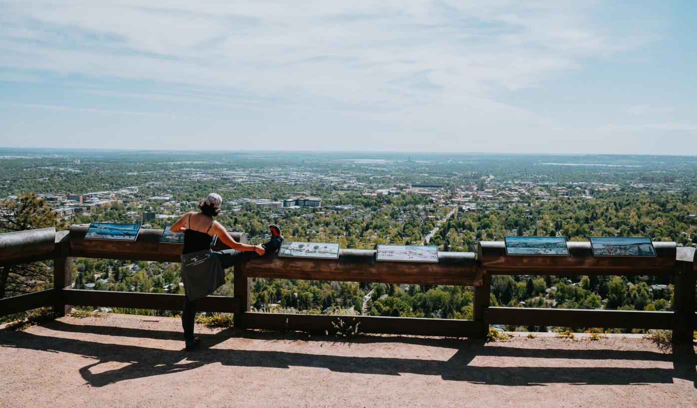
A pedestrian stretches as she takes in the view from the Panorama Point lookout along Flagstaff Road on Wednesday, May 21, 2025, in Boulder, Colo. (Parker Seibold, The Gazette)
Parker Seibold

A pedestrian stretches as she takes in the view from the Panorama Point lookout along Flagstaff Road on Wednesday, May 21, 2025, in Boulder, Colo. (Parker Seibold, The Gazette)
From its base of former ranchland that would become Chautauqua Park, Boulder residents through the early 1900s lobbied for more acquisitions of the mountain. There would be campaigns to improve the road as well — including under the Civilian Conservation Corps in the ‘30s.
The Flagstaff name had stuck by then, from one story or another. One is of quarreling men and a lost shirt that was tied to a pine, like a flag.
Another story is of a father and two youngsters betting they could rush up the mountain and be back for lunch, as recounted in a history by Mary Reilly-McNellan: “The father required that they take a flag with them to hang on an old dead tree near the top. This would be clearly visible in town to prove that they had indeed made it to the summit.”
It is a humble summit, limited to 7,000 feet or so. But between the 9 miles of road from the mountain’s foot to Gross Reservoir, the opportunities seem unlimited.
Keep your flag at home — there’s no need to rush.
Shuttles return to Rainbow Falls this summer as officials consider expanding Creek Walk for access
Sightseeing
From Chautauqua Park, the first overlook is about a mile up the road: Panorama Point, true to its name overlooking the city. Up ahead is Realization Point. It serves as a base for hiking trails and for accessing the summit; a half-mile spur road reaches the top.

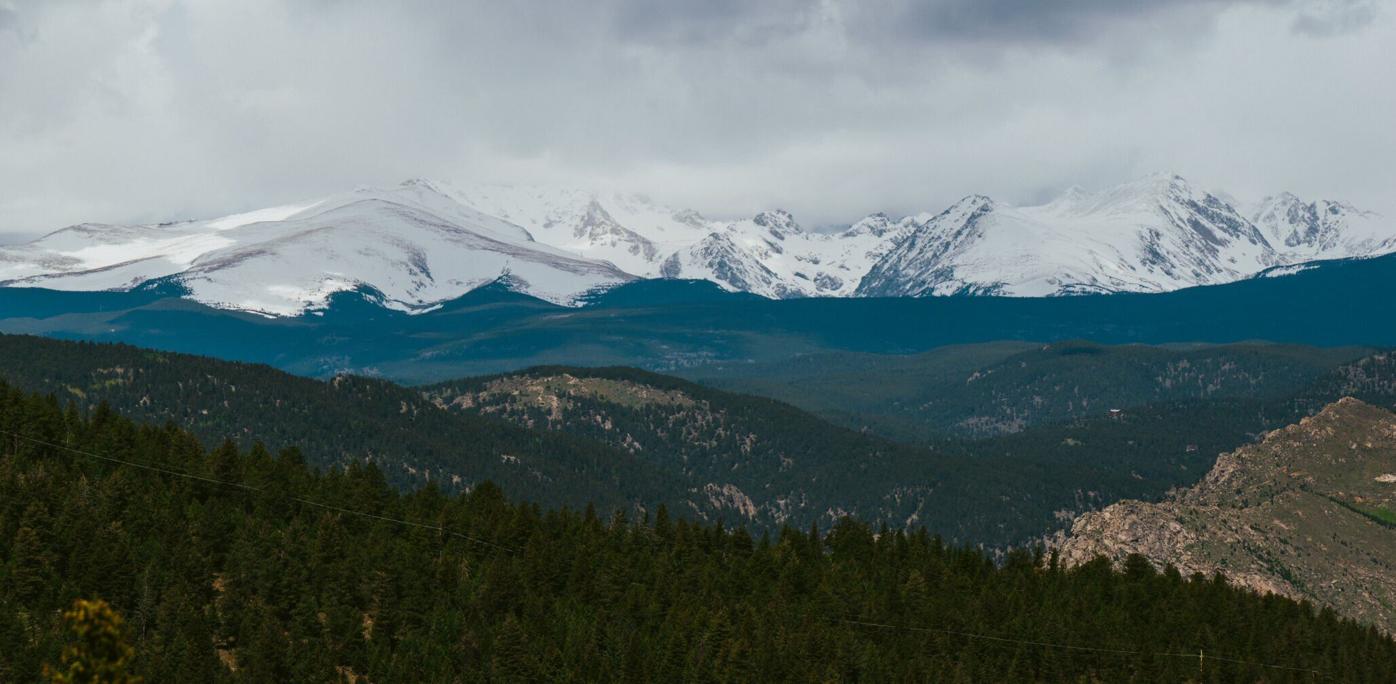
An expansive view of the mountains from Lost Gulch lookout along Flagstaff Road on Wednesday, May 21, 2025, in Boulder, Colo. (Parker Seibold, The Gazette)
Parker Seibold

An expansive view of the mountains from Lost Gulch lookout along Flagstaff Road on Wednesday, May 21, 2025, in Boulder, Colo. (Parker Seibold, The Gazette)
After Realization Point, the next stop is a must-stop: Lost Gulch, with short paths to sweeping views of Longs Peak and the Continental Divide. Along with the summit, it’s an ideal spot to catch a sunrise or sunset.
If heading off for trails from any of the parking areas, be aware of $5 fees for non-residents. Parking is prohibited before 5 a.m. and after 9 p.m.
Hiking
Flagstaff Trail starts at the bottom of the road, out of Chautauqua Park, and rises 2.1 miles to the summit, crossing the road several times along the way.
For another summit experience, the Green Mountain West Ridge Trail offers an out-and-back trip of about 3.5 miles. Kucar, who leads outings with the local Colorado Mountain Club, recommends a similarly distanced loop route: From Realization Point, Ranger Trail connects to E.M. Greenman Trail, which heads to Green Mountain and loops back on Ranger.
Check out Boulder Open Space and Mountain Parks’ online map to plot another popular loop from Realization Point, incorporating Gregory Canyon, Crown Rock, Flagstaff and Range View trails.
Popular Colorado Springs park road and trail remain closed, awaiting assessment
For a longer loop, check out Walker Ranch on the other side of the road. The Boulder County-owned open space boasts a nearly 8-mile loop that traverses Eldorado Canyon. The trail is open to bikes, unlike trails on the city-owned side of Flagstaff.
On a hot day, Kucar loves the shade along Chapman Drive, which connects Flagstaff Road to Boulder Canyon. Chapman Drive is closed to vehicles.
Cycling

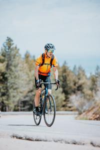
A cyclist pedals up Flagstaff Road on Wednesday, May 21, 2025, in Boulder, Colo. (Parker Seibold, The Gazette)
Parker Seibold

A cyclist pedals up Flagstaff Road on Wednesday, May 21, 2025, in Boulder, Colo. (Parker Seibold, The Gazette)
For serious cyclists around town, Flagstaff Road is a rite of passage. Take it from Roy Burger, president of Boulder Cycling Club: “The whole ride is an epic one, especially the first time you do it. It’s a beast of a climb.”
From bottom to top, it’s about 4.5 miles and 2,000 feet of vertical gain over heavily trafficked, hairpin turns with slim to no shoulders. Farther on, toward Walker Ranch, a row of mailboxes mark the extended, more challenging ride known as Super Flag.
Burger’s preference: Grinding up Chapman Drive (avoiding vehicles) from Boulder Canyon and dropping down the front side of Flagstaff Mountain. “It’s a lot of fun, but you gotta be very careful,” he says. “You can get a lot of speed.”
Fun on rock
Flagstaff is a hub for bouldering, packed with sharp, unforgiving and rewarding rock that has molded generations of climbers. Mountain Project cites nearly 400 problems — “few beginner problems, and not a whole lot of world class problems, but tons to pander to the intermediate climber.”
Monkey Traverse might be the best known and most crowded. A city webpage lists other classics: First Overhang, The Pillar, Hollow’s Way and Trice, all not far off the road. The Crown Rock parking area is a popular launchpoint.
Fun on water
Past Walker Ranch, Flagstaff Road meets Gross Reservoir, spanning about 440 surface acres between the foothills. It’s the spot for summertime picnicking, kayaking and paddleboarding. Anglers and hikers also converge at the North Shore parking lot.
A fair warning from site-managing Denver Water: “Expect the lot to reach capacity early in the day on busy weekends and remain full most of the day.”
If you’re wanting to stick around for the night, have a high-clearance, four-wheel drive vehicle for the hour-long drive to the Winiger Ridge Campground. The 31 sites are first-come, first-served.


